The keyline design is unique to each property and will be formulated from evaluation of water movements over the land, with the idea of controlling and making use of this resource in the management of the land.
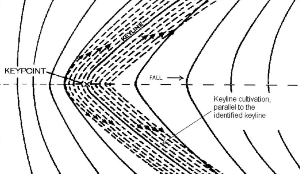
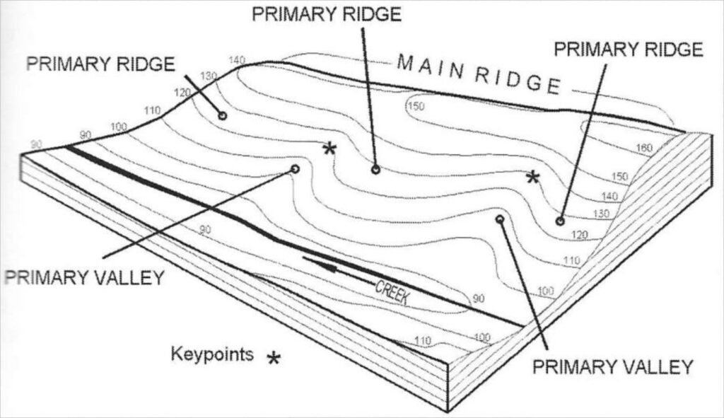
The keypoint occurs at the base of the steepest part of the slope in the center line of a valley. This is the fall line path that water currently follows.
The keyline of a valley is a contour line that runs through the keypoint. The ends of the keyline are where the contour
changes direction from the valley to the ridge.
Water movement over the land and the land’s features are directly related to each other, and water resources can only be used if they can be controlled.
Other factors such as climate, geology and rainfall patterns historically determined the land’s topography. Controlling water is the main focus in keyline planning as this is one variable which can be manipulated.
Drawings excerpted from “Water for Every Farm” by P. A. Yeomans and Ken Yeomans
Request Keyline Design Information